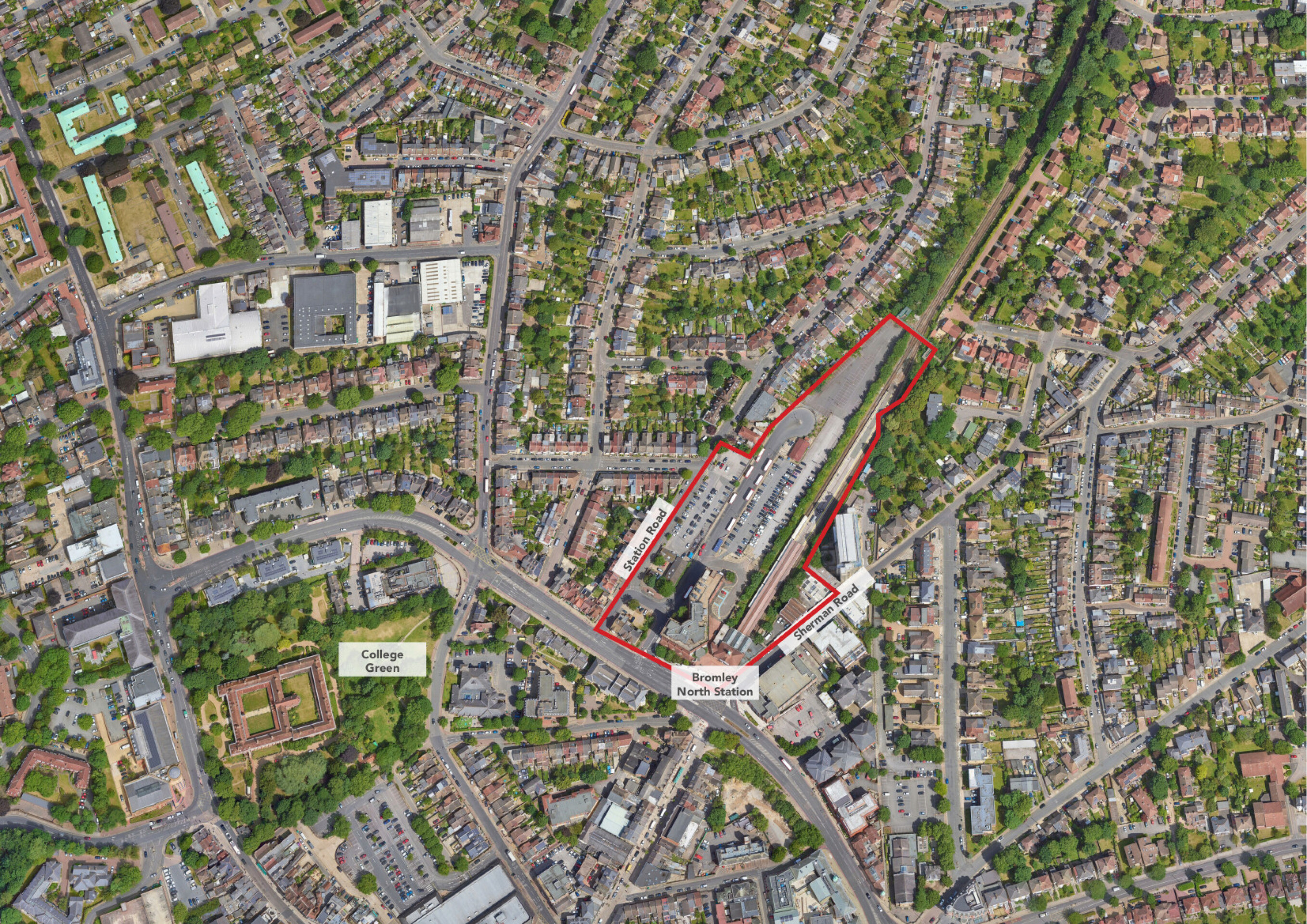
The site forms part of allocation site 2, Bromley North Gateway, in Bromley’s Local Plan 2019, shown on map 1.
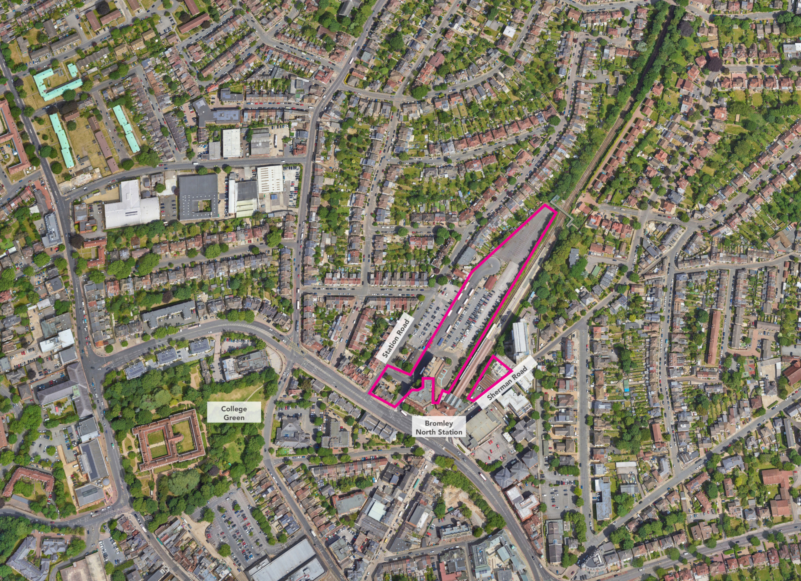
The proposed development site, shown on map 2, comprises the station car park and TfL stands, 6-10 Sherman Road (excluding 10A Sherman Road) and the block on the corner of Tweedy Road and Station Road.
The allocation site policy is for “redevelopment for 525 residential units, 2,000sqm of office space, with community and retail uses. The allocation also sets out a clear requirement for the development of a transport interchange.”
The Town Centre SPD, October 2023, sets out further guidance for development of the site which “will be expected to provide a sensitive and effective transition between the adjoining low rise residential areas and the higher density town centre; and respect and enhance the setting of the Grade II listed Bromley North Station building. Taking into account the local context (including the proximity of the listed station building) and relevant reference heights, the Council considers that high density development of around 4 to 8 storeys would be appropriate for this location. A taller element of around 10 storeys may be suitable for part of the site, referencing the existing 10 storey Northpoint House although this would be subject to detailed design considerations.”
Key parameters for development are:
- Permeability
- Incorporation of green infrastructure
- Exemplary design quality
and urban integration goals set out by the SPD.
Bromley Local Plan:
- You can access the Bromley Local Plan here.
Bromley Town Centre Supplementary Planning Document (SPD):
The Bromley Town Centre SPD can be accessed here.

